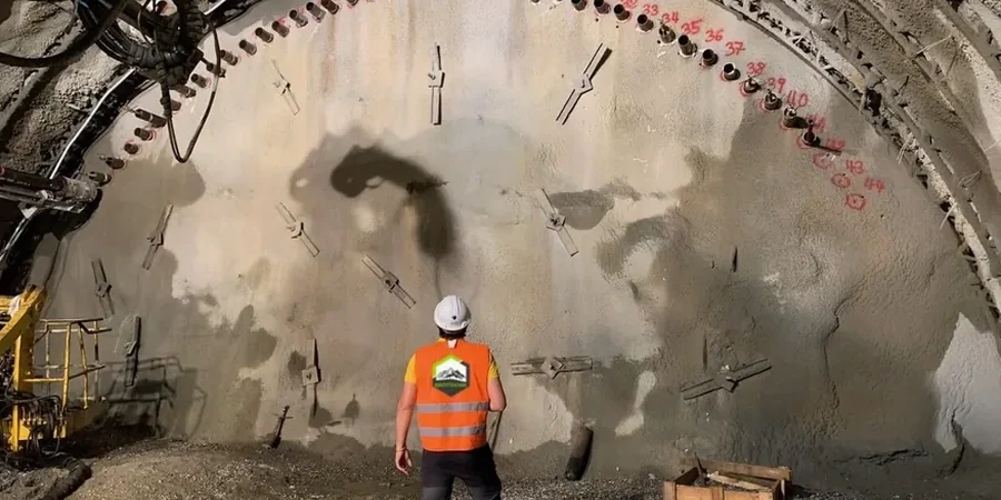
Kingston sits on a complex geological base where the Paleozoic limestone of the Ordovician period meets deep glacial till and localized marine clay pockets. The Ontario Building Code, supplemented by CSA A23.3 for concrete structures and referenced NBCC geotechnical provisions, requires continuous monitoring when an excavation exceeds certain depth thresholds or is adjacent to heritage structures. Around the downtown core near Princess Street and the waterfront, many buildings date back to the 1840s, and the limestone bedrock can be surprisingly close to the surface. Yet just a few hundred metres north, the overburden thickens, and the water table fluctuates sharply with Lake Ontario levels. In our experience, no two excavation sites in Kingston behave the same way. We start every project by reviewing historical borehole records from the Rideau Canal era and modern city datasets, then we design a monitoring plan that tracks lateral movement, settlement, and pore pressure in real time.
Limestone in Kingston can be competent and then dissolve into a karstic void within a metre — you monitor for the unexpected, not just what the borehole log says.
Our approach and scope
Site-specific factors
The freeze-thaw cycle in southeastern Ontario introduces a seasonal risk that many monitoring programs overlook. From November through March, the upper metre of overburden expands and contracts, which can mask early settlement signals if you are only reading surface monuments. Around the Cataraqui River floodplain and low-lying areas near Portsmouth Olympic Harbour, the marine clay layers are prone to creep deformation when an excavation removes lateral confinement. We have seen cases where a shoring wall moved less than 3 mm during summer excavation but accelerated to 9 mm during a January cold snap simply because the frozen crust changed the stress distribution in the bracing system. That is why our baseline readings always capture a full seasonal profile, and we design the instrumentation plan to isolate thermal effects from genuine ground movement. Without this level of scrutiny, a contractor risks misinterpreting data and either over-reacting with costly mitigation or under-reacting until a building façade cracks.
Watch the video
Regulatory framework
NBCC 2015 (National Building Code of Canada) Part 4 structural design and geotechnical provisions, CSA A23.3:19 Design of Concrete Structures — shoring and formwork loading references, Ontario Regulation 213/91 (Construction Projects) excavation safety and trenching requirements, ASTM D6230 Standard Guide for Monitoring Ground Movement Using Probe-Type Inclinometers, OPSS 206 (Ontario Provincial Standard Specification) for excavation and grading
Related services
Real-time automated deformation monitoring
Networked total stations with prisms mounted on shoring walls and adjacent buildings, programmed to record coordinates every 30 minutes and push alerts when displacement rates exceed the project-specific action levels agreed with the geotechnical engineer.
Inclinometer and piezometer installation and readout
Downhole inclinometer casings grouted into boreholes behind the shoring line to track subsurface deflection profiles, paired with vibrating wire piezometers that capture groundwater pressure changes during staged dewatering.
Pre-construction condition surveys and vibration control
Detailed crack mapping, photo documentation, and vibration monitoring per CSA A23.3 for rock removal operations near Kingston General Hospital, Queen's University labs, and other vibration-sensitive facilities.
Typical parameters
Common questions
When does the Ontario Building Code require excavation monitoring in Kingston?
The Ontario Building Code, through its adoption of NBCC Part 4, effectively mandates monitoring when an excavation depth exceeds 3.0 m in urban areas or when the work is within a zone of influence of adjacent buildings. In practice, any shored excavation deeper than a single-storey basement in downtown Kingston or near limestone heritage structures will need a monitoring plan approved by the geotechnical engineer of record. The city may also require it as a condition of the shoring permit.
How do you handle vibration monitoring when rock excavation is needed in the limestone?
We follow the CSA A23.3 guideline limits for vibration on adjacent structures, typically capping peak particle velocity at 12.5 mm/s for older unreinforced masonry buildings common in Kingston. Our team installs triaxial geophones on the foundation walls of the nearest sensitive structures and monitors in real time during hoe-ramming or blasting. If readings approach 80% of the threshold, we notify the site superintendent immediately so the contractor can adjust hammer size or blast charge.
What is the typical cost range for an excavation monitoring program in Kingston?
For a standard mid-sized excavation in Kingston — say a two-level underground parking garage with shoring on three sides — the monitoring package typically falls between CA$1,130 and CA$3,400 per month depending on the number of instrument stations, reading frequency, and whether automated reporting is required. A full four-month program with inclinometers, piezometers, and automated total stations will be at the higher end of that range.
Can you monitor an excavation that is already underway without baseline data?
It is possible but not ideal. Without a pre-construction baseline, we lose the reference for zero movement, which makes it harder to distinguish between normal thermal effects and genuine deformation. In these cases, we install instruments immediately and take an accelerated series of readings over the first 48 hours to establish a stable trendline. We also conduct a rapid crack survey on adjacent buildings so that any future change can be measured from the date of first inspection onward. More info.